This hour's deals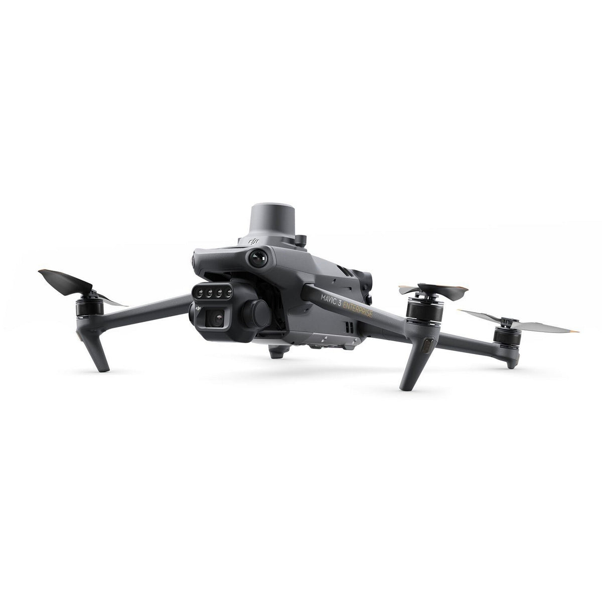 −30%
Tech · My Surveying Direct
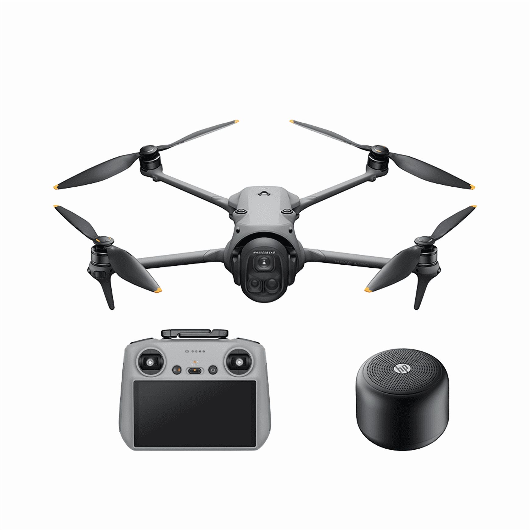
DJI Mavic 3M Multispectral Drone
Deal score 5.9 · Good deal
$3,999.00$5,729.00 My Surveying Direct's regular price
You save $1,730.00 at My Surveying Direct
Deal.ai's agents found this deal on November 19. The store may have changed its price since.
Why it's a great deal
- Elsewhere right now: Drone Nerds $5,729.00
- Cheaper than the other store selling it right now
- My Surveying Direct lists its regular price at $5,729.00: 30% off by its own figures
Every store we checked
- My Surveying DirectNew
In stock
$3,999.00Checked 36 min ago - TS2 SpaceNew
In stock
$4,024.43+ $2.00 shippingChecked Nov 10 - AVLgear.comNew
In stock
$4,618.00Free shippingChecked Nov 13 - Aerosmart UAVNew
In stock
$4,762.42Free shippingChecked Nov 13 - Infinit Drones CorpNew
In stock
$5,354.12+ $127.00 shippingChecked Nov 10 - DroneFly.comNew
In stock
$5,499.00Free shippingChecked Nov 14 - DSLRPros.comNew
In stock
$5,499.00Free shippingChecked Nov 14 - Grip SupportNew
In stock
$5,499.00Free shippingChecked Nov 14 - Ferz SupplyNew
In stock
$5,499.00Free shippingChecked Nov 14 - Wicked Aerial PhotographyNew
In stock
$5,499.00Free shippingChecked Nov 14 - Impulse.New
In stock
$5,499.00+ $24.60 shippingChecked Nov 14 - Green Vista LivingNew
In stock
$5,599.00Free shippingChecked Nov 13 - AeroSprayNew
In stock
$5,599.00Checked Nov 13 - Drone Deer RecoveryNew
In stock
$5,629.00Checked 36 min ago - Drone Deer RecoveryNew
In stock
$5,629.00Free shippingChecked Nov 13 - Serious DetectingNew
In stock
$5,699.00Free shippingChecked Nov 14 - Taft DroneNew
In stock
$5,699.00Checked Nov 13 - Drone NerdsNew
In stock
$5,729.00Checked 36 min ago - Volitant TechnologiesNew
In stock
$5,729.00Checked Nov 14 - Terrestrial ImagingNew
In stock
$5,729.00Free shippingChecked Nov 13 - theadvantagempire.comNew
In stock
$5,729.00Free shippingChecked Nov 13 - Chief Miller ApparelNew
In stock
$5,743.40Free shippingChecked Nov 14 - eBayPre-owned
Availability unknownSold by bluvette0526 (100% positive, 28 ratings)Returns: Set by the eBay seller; the eBay Money Back Guarantee covers an item that doesn't arrive or isn't as described.
$4,500.00+ $7.72 shippingChecked Nov 14 - eBayNew
Availability unknownSold by rhinoliningso_0 (100% positive, 7 ratings)Returns: Set by the eBay seller; the eBay Money Back Guarantee covers an item that doesn't arrive or isn't as described.
$5,400.00+ $7.60 shippingChecked Nov 14 - Talos DronesNew
Availability unknown
$5,599.00Free shippingChecked Nov 13 - AdoramaNew
Out of stock
$5,729.00Free shippingChecked Nov 13 - King of Hobby DealsNew
Availability unknown
$3,839.99Checked Nov 5 - WellbotsNew
Availability unknown
$4,299.00Checked Nov 5 - MaverickNew
Availability unknown
$5,329.00Checked Nov 5 - ShopNew
Availability unknown
$5,499.00Checked Nov 5 - Grip SupportNew
Availability unknown
$5,499.00Checked Nov 5 - Impulse.New
Availability unknown
$5,499.00Checked Nov 5 - Serious DetectingNew
Availability unknown
$5,699.00Checked Nov 5 - GroDronesNew
Availability unknown
$5,729.00Checked Nov 5 - Chief Miller ApparelNew
Availability unknown
$5,743.40Checked Nov 5
Store links may earn us a commission.
Reading My Surveying Direct’s product page for the details…
About it
DJI Mavic 3 Multispectral: Integrated RGB and Multispectral Surveying Platform for Precision Agriculture
The DJI Mavic 3 Multispectral redefines what a sub-kilogram UAV can deliver for precision agriculture and environmental monitoring. At 951 grams with its RTK module pre-mounted, it integrates a 20MP 4/3 CMOS RGB camera with four 5MP multispectral cameras, scanning green, red, red edge, and near-infrared bands simultaneously, into a foldable airframe that transitions from carrying case to airborne in minutes.
For agronomists, survey teams, and natural resource managers who need field-grade multispectral data without the logistical overhead of larger platforms, the Mavic 3M delivers the imaging system, positioning accuracy, and flight endurance to support operations at scale.
Key Features and Benefits
20MP RGB camera: 4/3 CMOS with mechanical shutter eliminates motion blur at mapping speeds.
Four 5MP multispectral cameras: simultaneous G, R, RE, and NIR capture in a single pass.
RTK module: pre-mounted for centimeter-level accuracy with microsecond synchronization.
Sunlight sensor: per-image irradiance recording for consistent NDVI across variable conditions.
43-minute endurance: covers up to 200 hectares per flight under optimal conditions.
O3 Enterprise transmission: 15 km range with 1080p/30fps live view to RC Pro controller.
APAS 5.0: omnidirectional obstacle avoidance active in Normal and Tripod flight modes.
Terrain follow: real-time vision-based or DSM-based altitude adjustment over sloped terrain.
951 g foldable airframe: compact enough for a standard field bag, deployable in minutes.
Multi-constellation GNSS: GPS, Galileo, BeiDou, and GLONASS for reliable autonomous navigation.
Where conventional mapping platforms require separate RGB and multispectral flights, the Mavic 3M captures both datasets in a single pass. The pre-mounted RTK module synchronizes with the flight controller and all five cameras at the microsecond level, tagging each image with centimeter-accurate geospatial coordinates, no ground control points required.
A built-in sunlight sensor embeds solar irradiance data directly in every image file, enabling light compensation during reconstruction and producing NDVI results that remain consistent across different times, weather conditions, and flight dates. With 43 minutes of flight endurance and coverage of up to 200 hectares per mission, the Mavic 3M is a platform built for operators who need to move fast and trust their data.
Dual-Sensor Data From a Single Deployable Platform
For fleet managers and solutions partners deploying multispectral surveying programs, the Mavic 3M's value is in what it consolidates. A single aircraft, a single flight, and a single dataset covers both RGB mapping and four-band spectral analysis — eliminating the scheduling, coordination, and data reconciliation that comes with running separate platforms for each task.
The RC Pro Enterprise controller's 5.5-inch, 1,000 nit display supports full mission management in direct sunlight, and the DJI Pilot 2 app's integrated flight task library handles waypoint, mapping, oblique, and linear missions without external planning software.
For organizations building out multi-site precision agriculture programs or environmental monitoring networks, the Mavic 3M's open Cloud API and MSDK5 support direct integration with third-party platforms and proprietary operational workflows.
Compatibility and System Integration
DJI RC Pro Enterprise: included controller with 5.5 in display, 3-hour battery, and GNSS.
D-RTK 2 High Precision GNSS Mobile Station: expands RTK range for large-scale survey operations.
Network RTK: NTRIP server integration via RC Pro Enterprise Wi-Fi for continuous correction.
Specs
- Color
- Red
- Operating Distance
- 9.3 mi Operating Distance
- Flying Time
- 43 min flying time
- With Camera
- Yes
- Maximum Speed
- up to 47 mph
About the DJI Mavic 3M Multispectral Drone
The DJI Mavic 3M is a folding drone built for agriculture and land surveying. It pairs a 20MP RGB camera with a four-band multispectral sensor (green, red, red edge, near-infrared) on one gimbal, so you can capture visible and crop-health imagery in a single flight. DJI rates flight time at 43 minutes and transmission range at 9.3 miles. A pre-mounted RTK module and a sunlight sensor support consistent, repeatable NDVI mapping. It is a specialist tool that costs far more than consumer Mavic models, so it only pays off if you need multispectral data regularly.
Best forFarmers and agronomists mapping crop healthLand and vegetation surveyorsDrone service providers adding multispectral workResearchers and precision-ag teams
Pros
- RGB and four-band multispectral cameras on one gimbal, so one flight captures both
- 43-minute rated flight time covers large fields per battery
- 9.3-mile rated transmission range for wide-area missions
- RTK module for centimeter-level positioning on mapping flights
- Folding Mavic body is far more portable than older multispectral drones